

July 2025 EZNews
- Dr. Scott Dennstaedt

- Jun 30, 2025
- 15 min read
Updated: Jul 8, 2025

Greetings and thank you for taking a few minutes to read the 51st edition of EZNews!

We appreciate those members who have opted for automatic monthly renewal of their EZWxBrief membership. If you haven't yet set up your account to renew automatically, please sign in and follow the prompts if your membership has expired. Otherwise, go to the User Profile page (see right) and tap or click on the Renew button. This allows you to set up your monthly renewal using a Visa, MasterCard, or Discover credit card (we do not accept American Express at this time), ensuring you continue to enjoy the simplicity of EZWxBrief.
Are you new to EZWxBrief?

For members new to EZWxBrief, you won't find EZWxBrief in the App Store or Google Play Store. For the best user experience, EZWxBrief is optimized to run as a progressive web app (PWA) and must be installed on your device. This is quick and painless and takes less than 10 seconds per device. Follow the instructions in this video or visit the 180+ page Pilots Guide for more information on how to install EZWxBrief as a PWA on all of your devices. For example, shown to the left, here's how to install EZWxBrief on your iPhone or iPad...it's that EZ!
In Flight Weather Essentials for Pilots eight-week class now open for registration
The next live class, In Flight Weather Essentials for Pilots will begin on Monday, September 15, 2025. The class will meet each subsequent Monday night for eight weeks. This announcement is a little bittersweet given it will be the last live class that Scott teaches as he eases into retirement over the next few years. So, if you are interested in enduring one more class with Scott, early registration has begun so you can reserve your spot before general registration begins on August 1, 2025.
The early-bird tuition for the class is $295 if registered by July 31, 2025. Tuition will increase to $345 after this date. Note that a waiting list will be started once the class reaches maximum capacity - so register today to secure a seat at the lowest price in this unique aviation weather course for pilots.
Once your registration is complete, you should receive two emails. The first is a confirmation of the payment for your registration and a second is the Google Meet link to join each session. Please check your spam folder if they have not reached your inbox. Important: the same link will be used for each and every class.
Each class will start promptly at 8 pm eastern time on Mondays beginning on September 15, 2025. You can expect about 45-60 minutes of instruction with 15 minute s added to allow for questions and spillover. The sessions will be held using Google Meet and each class will be recorded and a personal link to the recording along with a PDF of the presentation and quiz will be provided to you within 36 hours. Therefore, it is not mandatory that you attend each live class to get the most from the eight-week course. Although you can join the class on a handheld device using the Google Meet app, it is recommended that you use a laptop or desktop computer (Google Chrome is recommended).
While it is not mandatory that you previously attended the Weather Essentials and Advanced Weather Essentials for Pilots classes, it is highly recommended. You can purchase a recording of these two classes here and here, respectively. Save even more by purchasing our limited-time combo deal here.
There's no doubt that fair weather environments and severe clear conditions provide the best flying experience. However, pilots that use their aircraft to travel longer distances and those that fly more frequently will inevitably increase their exposure to some adverse weather. This class will enable you to recognize serious adverse weather environments both in how to avoid them and provide guidance on how to negotiate the best path out of them or around them. In the end, this class isn't about dealing with weather emergencies as they occur, but how to avoid them before they happen.
In a nutshell, this eight-week course is specifically directed at certificated private/commercial pilots, flight instructors and designated pilot examiners who feel their weather skillset is significantly lacking. It is open to pilots with and without an instrument rating. Putting it succinctly, this is designed to take the serious cross country pilot to the next level.
AirVenture savings continues through July 27th!
If you were not able to attend any of the three live aviation weather classes, you have the opportunity to get the lowest prices available on the recording for each of these three classes. This includes the Weather Essentials for Pilots, Advanced Weather Essentials for Pilots and the Skew-T Weather Essentials classes.
Weather Essentials for Pilots (12 classes)
Advanced Weather Essentials for Pilots (10 classes)
Skew-T Weather Essentials (12 classes)
Check out this free video from the sixth Advanced Weather Essentials for Pilots 10-week class that discusses convective guidance and considerations. This free video is nearly an hour long and will give you a sample of the content found in each of the three programs mentioned above.
Each program contains hyperlinks to all of the recorded videos as well as hyperlinks to PDFs containing the slides presented in each class. In addition to purchasing each of these three classes individually, for a limited time we are offering a Combo pricing for the Weather Essentials and Advanced Weather Essentials classes and a Triple Combo pricing to purchase all three programs.
Upon purchase you will be provided a link to download a Summary Guide. This same link to the purchased program will also be provided within an email. The emailed link is valid for 30 days of purchase. This Summary Guide is a PDF that includes the following -
Table of contents
Hyperlinks to the unlisted video recordings of each class
Hyperlinks to a PDF containing the slides for each class
Hyperlinks to each quiz and quiz answers for each class (no quizzes are included for the Advanced Weather Essentials for Pilots class)
This content is provided for your personal use only. Please do not share this or post this content online. We appreciate your cooperation. This offer is available for a limited time and ends on July 27, 2025. Don't delay, purchase access to these programs today!
Attending AirVenture this year?

Hard to believe, but it's that time of the year again! EZWxBrief will once again maintain a vendor booth at EAA's AirVenture in Hangar C (Booth 3082) this year and we are looking forward to meeting many of you there. This year will be a little bittersweet. With rising costs of attending this event, this will be our final time attending AirVenture as a vendor. Therefore, stop by Hangar C during the event and say hello and get a demonstration of EZWxBrief v2 or attend one of Scott's many forum presentations planned throughout the week. The detailed schedule is shown below or you can view Scott's schedule online here. So mark your calendar and we look forward to seeing you there!
Mon, July 21 at 8:30 am - Turbulence basics (Forum Stage 6)
Mon, July 21 at 2:30 pm - Intro to the Skew-T Diagram (Forum Stage 10)
Tue, July 22 at 10 am - Ice contaminated tailplane stalls (Forum Stage 9)
Wed, July 23 at 10 am - Deciphering flight level weather (Forum Stage 5)
Thu, July 24 at 11:30 am - A dangerous combo, IFR and weather (Forum Stage 10)
Thu, July 24 at 2 pm - Five weather rules of thumb that could kill you (PPC)
Fri, July 25 at 2 pm - 5 things you must know about datalink weather (AOPA Pavilion)
The Daily Weather Roundup for AirVenture
Starting on Monday, July 14th, keep an eye out for The Daily Weather Roundup, with live analysis of the weather for anyone planning to fly to the event or if you want to learn more about how to interpret all of those pesky forecasts. The program will be daily with the last episode on Friday, July 18th. The schedule for these episodes will be posted on the EZWxBrief YouTube community page. If you cannot attend live, they will be recorded and will appear in the AirVenture playlist so they will be easy to find. Don't forget to subscribe to the EZWxBrief YouTube channel (@ezwxbrief) to avoid missing these daily programs. Please spread the word to other pilots on your own social media accounts and to anyone who might benefit from watching these daily videos.
Before you leave the show this year, feel free to stop by the booth during the week and ask Scott to do an overview the weather using the EZWxBrief progressive web app for your departure out of the Oshkosh area and back to your home base. Lastly, we'll have plenty of The Skew-T log (p) and Me and a few Pilot Weather books for sale if you are interested. Looking forward to seeing you in Oshkosh this year!
Pilot Workshops mastery meet-n-greet at AirVenture
If you are a fan of the IFR Mastery series from Pilot Workshops, then you'll want to attend the IFR Mastery meet-n-greet from 5:30 pm to 7:30 pm on Wednesday, July 23rd at AirVenture. You will be able to chat with many of the instructors that participated in the round table discussions and content over the last 10+ years. Scott was a founding member of this group and will be attending the event. It will be hosted by Sporty's in their tent located right outside of Hangar B. We are told that they have ordered tables, food, and bartenders...so don't miss out on this first-of-a-kind opportunity.
A change to G-AIRMETs for turbulence
In response to a National Transportation Safety Board (NTSB) safety recommendation for the NWS to “provide a primary aviation weather product that specifically addresses both the potential for and the existence of mountain wave activity and the associated aviation weather hazards”, the NWS proposes to include mountain wave turbulence in the Graphical AIRMET (G-AIRMET) product.
The Aviation Weather Center (AWC) routinely issues forecasts for moderate turbulence via G-AIRMETs. The AWC is planning to add a mountain wave descriptor to the high level and low-level turbulence polygons when mountain waves are associated with the turbulence flight hazard. Currently, the plan for operational implementation of mountain wave information in the turbulence G-AIRMETs is slated for April 2026. The FAA/NWS joint-agency working group is aware of the proposed change and concurs with the addition to the turbulence G-AIRMETs.
Under pressure
No, this doesn't address the anxiety you might feel while shooting an instrument approach to minimums or the intense pressure to keep your speed up after a slam dunk vector to the final approach fix into a busy airport. This is strictly talking about atmospheric pressure. It’s not something we ordinarily dwell on before or during a flight. But, if you fly in a location where the mountain peaks are plentiful, then you should get better acquainted with how much the altimeter setting can truly vary in mountainous areas even when the weather is tranquil.
Of all of the weather elements measured by sensors located at airports, atmospheric pressure is perhaps the most underappreciated, but the most important, especially to any pilot flying under instrument flight rules (IFR). In fact, pressure is the only weather element that cannot be directly observed or qualitatively sensed by a trained observer or pilot. Without it, pilots have no way to establish their height above the earth’s surface with any certainty. Consequently, the pressure sensor is the most reliable and accurate sensor in the array. So you can bet that this equipment is carefully checked for accuracy quite often.
There are several ways to represent the surface pressure. First, let's start with what is actually measured at weather stations, that is, atmospheric pressure or what is referred to as station pressure. For the Automated Surface Observing System (ASOS), there are three pressure sensors located at most towered airports (usually located inside a climate controlled structure, such as an observing office or air traffic control tower). Six pressure readings are taken per minute by each sensor and a 1-minute pressure value is determined. If any of the six readings are missing or if the 1-minute pressure value differs by more than 0.04 inch in comparison to the other sensors, then the pressure value is set to “missing” and the maintenance check indicator is appended to all subsequent METAR or SPECI reports. Given this redundancy, it’s very difficult to get a faulty reading.
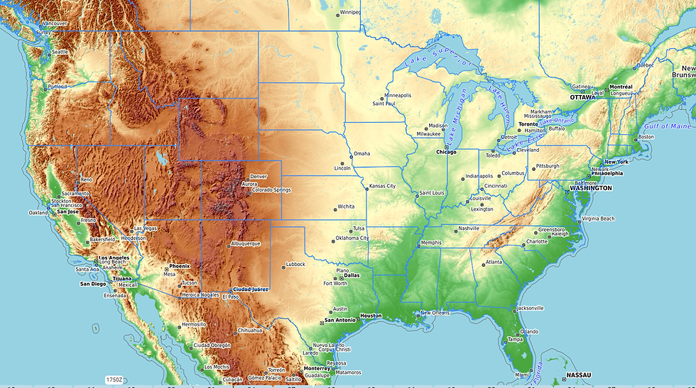
In and of itself, this measurement is useless even if it is accurate and reliable. As you likely know, the air pressure decreases rather rapidly with increasing height. So, if we were to make a plot of actual reported station pressures at a specific time over the entire U.S. what we'd really see is a relief map of the terrain as shown below. Essentially, there would be lower pressures always at higher elevations. As you can imagine this isn't very practical for analyzing the surface weather patterns so a method is needed to remove the effect of the differences in station elevation. This requires that the measured atmospheric station pressure be reduced to a common reference plane called mean sea level (MSL) height.
There are two methods for achieving this; the first is the altimeter setting and the second is referred to as a reduction to sea level pressure (SLP). The one that pilots are most familiar with is the altimeter setting. It’s typically provided to pilots on a standard briefing and may be obtained on the ground or in flight through air traffic control (ATC) or by listening to the local ground-to-air weather broadcast from an AWOS, ASOS or ATIS. According to Chapter 11 of the Federal Meteorological Handbook, the altimeter setting is defined as, “The pressure value to which an aircraft altimeter scale is set so that it will indicate the altitude above mean sea level of an aircraft on the ground at the location for which the value was determined.” While this definition is accurate, it leaves out some important details.
Nevertheless, the altimeter setting is calculated by a pressure reduction computation in accordance with the International Standard Atmosphere (ISA). More importantly, the altimeter setting has no temperature dependence, but uses a fancy formula to try and guess what the air pressure measurement would be if we could dig a big hole in the ground and move the airport down to sea level elevation.
Similarly, SLP is a theoretical pressure at the station if the station were actually at sea level. The two computations are somewhat different in that the SLP computation does not assume a standard atmosphere; instead, the computation takes into account the reported station temperature. In fact, it uses a 12-hour mean ambient temperature computed once each minute from the current and previous 12-hour reported 5-minute average temperature. An average temperature is used to reduce any diurnal (daily) effects.
Compared to the high degree of accuracy of the measured station pressure, computing these two theoretical pressures is actually quite crude and requires a slightly different method to achieve the same result (pressure at sea level) although not necessarily the same intrinsic value. In the end, both methods attempt to calculate what the pressure would be at the bottom of a large hole in the earth assuming the bottom of the hole is at sea level. To do this requires that you consider the station elevation, station pressure and perhaps the station temperature (for SLP). Bad guesses as to what this temperature profile should look like “below the ground” can result in errors in either of these calculations, especially so in regions of sharp terrain.
Leadville, Colorado (KLVX), for instance, is one of the highest incorporated cities in the U.S. Here the absolute station pressure measured at the site is normally around 700 mb or 20.67 inches Hg. If the average sea level pressure is 1,000 mb, this means that nearly 300 mb must be added to obtain a reading at sea level. A mere one percent error in estimating the exact correction would result in a 3 mb error in SLP. The potential errors in the altimeter setting are larger for stations at very high elevations since more correction has to be applied. Let’s crunch some specific numbers.
The factor used to reduce station pressures to altimeter settings contains an exponential term that depends on the station elevation and hence can get fairly large rather quickly for high elevation stations. As examples, suppose the station pressure (measured at the station elevations) at all of the following stations is 700 mb (20.67 in Hg). In other words, we’re holding the pressure constant. You can see that the higher the elevation, the higher altimeter setting for a given constant station pressure.
Station Elevation (feet) Altimeter Setting (in Hg)
K20V 7,411 27.48
KLXV 9,928 29.88
KCCU 12,073 32.44
While all stations should report an altimeter setting, many do not report SLP. This is not a problem in the U.S. since most altimeters in aircraft do not allow for SLP settings. However, if you have datalink weather, you can certainly quickly retrieve altimeter settings for all reporting stations, even those with high elevations.
So you might be asking, will this apparent "error" cause me to hit anything solid? Probably not. The important point is to always use the altimeter setting provided by air traffic control (ATC) when flying under IFR or VFR with flight following. Even when flying VFR without ATC’s help, it may be tempting to pull up a surface observation or two broadcast to your datalink weather receiver and use the altimeter setting at Copper Mountain (KCCU) in central Colorado, for example. But that may put you off by nearly 500 feet from all of those other pilots that are using the altimeter setting for Eagle, Colorado, just 40 miles to the west. So if you were flying at 16,500 feet, you could be at the same altitude as those IFR aircraft flying at 16,000 feet using the Eagle altimeter setting.
Of course, if you are flying in or out of Leadville, Colorado, you should use still the altimeter setting provided by the ASOS on the field. This is because the altimeter in your aircraft also assumes a standard atmosphere and is designed to perform all of the same calculations (either mechanically or digitally) as the ASOS. You may find, however, as you are switching to or from the Leadville altimeter setting to the new setting provided by ATC, you may be doing quite a bit of twisting of the Kollsman knob.
The altimeter setting reflex
It’s the mindless and instinctive reach for the Kollsman knob whenever a pilot hears an altimeter setting. When ATC says, “altimeter 29.96” your hand immediately leaps toward the knob despite what other important tasks you may be performing at the time. We’re all guilty of this. But it’s really not a bad habit given that the altimeter setting is one of the most important single pieces of weather data you’ll use on every flight.
The importance of properly setting the altimeter cannot be overemphasized. Many instrument approaches have very little margin for error especially when the approach terminates with a circle to land. You don’t want to be circling with an incorrect setting causing you to be 100 or more feet below the MDA. A difference between an altimeter setting of 29.82 and 29.92 gives you that 100 foot error.
Fortunately, most local altimeter settings don’t vary significantly from one controller handoff to the next. There’s ordinarily not enough pressure gradient given the short span of distance between airspace sectors. Although, the general rule to remember is that when the actual pressure is lower than what is set in the Kollsman window, the actual altitude of the aircraft will be lower than what is indicated on the altimeter. Remember the mantra, “high to low look out below.”
First of all, while flying under IFR you always want to use the altimeter setting provided by ATC while en route. Failure to do so might prompt the controller to question your altitude. But at some point you have to transition your current altimeter setting to use the local altimeter setting at your destination. It’s this last setting that’s the most critical.
While there isn’t a right time to switch from the last ATC-delivered altimeter setting to the local altimeter setting at your destination airport, you certainly don’t want to be descending on the approach listening to the weather broadcast to get it. At the other extreme, you don’t want to change it too soon while still at your cruise altitude and 50 miles away from your destination.
If the altimeter setting at your destination airport is less than 0.10 in Hg from your current setting (and it usually is), it really doesn’t matter all that much when you switch it. It is generally a good practice to always switch the altimeter setting as you listen to the ground-to-air broadcast and reported to ATC that you have the numbers. Shortly after that you have likely negotiated the approach you want with ATC and have already started your descent. It's also not a bad habit to write down the latest altimeter setting from the ground-to-air broadcast and recheck the altimeter setting right after the approach clearance is given or when you have the airport in sight and a visual clearance is issued.
Is it an acceptable substitute to use your datalink weather broadcast versus listening to the weather over the ground-to-air broadcast such as ATIS, AWOS or ASOS? In most cases it probably is acceptable. But, a word of caution; always verify the issuance time on the surface observation before using the altimeter setting in the METAR. Even though METARs get updated quite frequently (every 12 minutes with SiriusXM), the surface observation could be an hour or more old as it appears on your display. A stale altimeter setting is not going to be an issue when you are hearing it directly from the horse’s mouth.
EZWxBrief v2 News
NOAA/NWS will be retiring the Model Analysis and Guidance (MAG) website later this year. This site is used by the EZWxBrief progressive web app to download and render a subset of the static imagery collections that include the GFS, NAM, HRRR, HREF and HRW-FV3 models. The retirement of the MAG site is part of an effort to privatize NOAA and remove resources such as these from the public view.
Consequently, in order to provide a similar version of these forecasts to subscribers, they will need to be created from scratch using the compressed raw forecast model data. NOAA expects a majority of this raw model guidance to be available for the time being although there is an expectation that it will also be discontinued. Please note, this is not a trivial development task and requires significant computer resources to build these forecasts. As a result, there will be a need to increase the monthly fee charged for the EZWxBrief app. Beginning on December 1, 2025, the new monthly subscription fee will increase by $1.00 to cover a portion of this initial and ongoing compute cost. We hope you understand the need for this change and continue to value the simplicity of EZWxBrief.
EZWxBrief v2.0.3 is the current version. There have been no new releases at this point in time.
Most pilots are weatherwise, but some are otherwise™
Dr. Scott Dennstaedt
Weather Systems Engineer
Founder, EZWxBrief™
CFI & former NWS meteorologist


Comments